This year's family holiday is planned in England. But since I am not a fan of big cities, and my girlfriend wanted some quality time with the kids, it was quickly decided that we would start the holiday separately. While Ine and the kids would enjoy just under three days of London, I would do some endurance training on the Ridgeway track.
Ridgeway trail: History
Ridgeway is a term from Anglo-sqxon times referring to ancient paths that run along high ridges. They are unpaved and simply rely on the hard ground to form a suitable surface. They form a more direct route than the modern roads we use today; modern roads tend to be on more level ground in valleys. The Ridgeway in England stretches for 137 km from Overton Hill near Avebury, Wilshire, to Ivinghoe Beacon near Tring, Buckinghamsire. The route has been used for 5,000 years by many different groups of people: travellers, farmers and armies. In the time of the Saxons and the Vikings, the Ridgeway was useful as a track to bring soldiers to Wessex. In medieval times, the route was used by drovers bringing animals to market. The Enclosure Acts of 1750 made the Ridgeway more permanent and the route clearer. In 1973, it became a National Trail, along with 14 others in England and Wales. It is a public road.
Ridgeway trail: Filip way 🙂
The Ridgeway trail is normally done in 6 or 7 stages. But as my girlfriend did not want to stay in London for more than 2.5 days, I had to improvise. The biggest problem was dividing up the trek correctly and where to sleep. Especially the first part is quite remote with few possibilities for overnight stays. But after a few evenings of puzzling I came up with a good division of the three days. Other new challenge for me was the luggage. I have undertaken organised multi-day treks several times before, as well as longer day treks on my own. But never before have I undertaken a multi-day trek independently. This does cause problems towards supplies and clothing, resulting in a heavy running backpack. With a full drinking bag, this quickly ran to about 7kg. Another problem is that technical runs with lots of altimeters are my favourites, faster flat courses are not really my favourite. And let the Ridgeway be precisely a flatter faster parkour. In other words, a fun challenge.
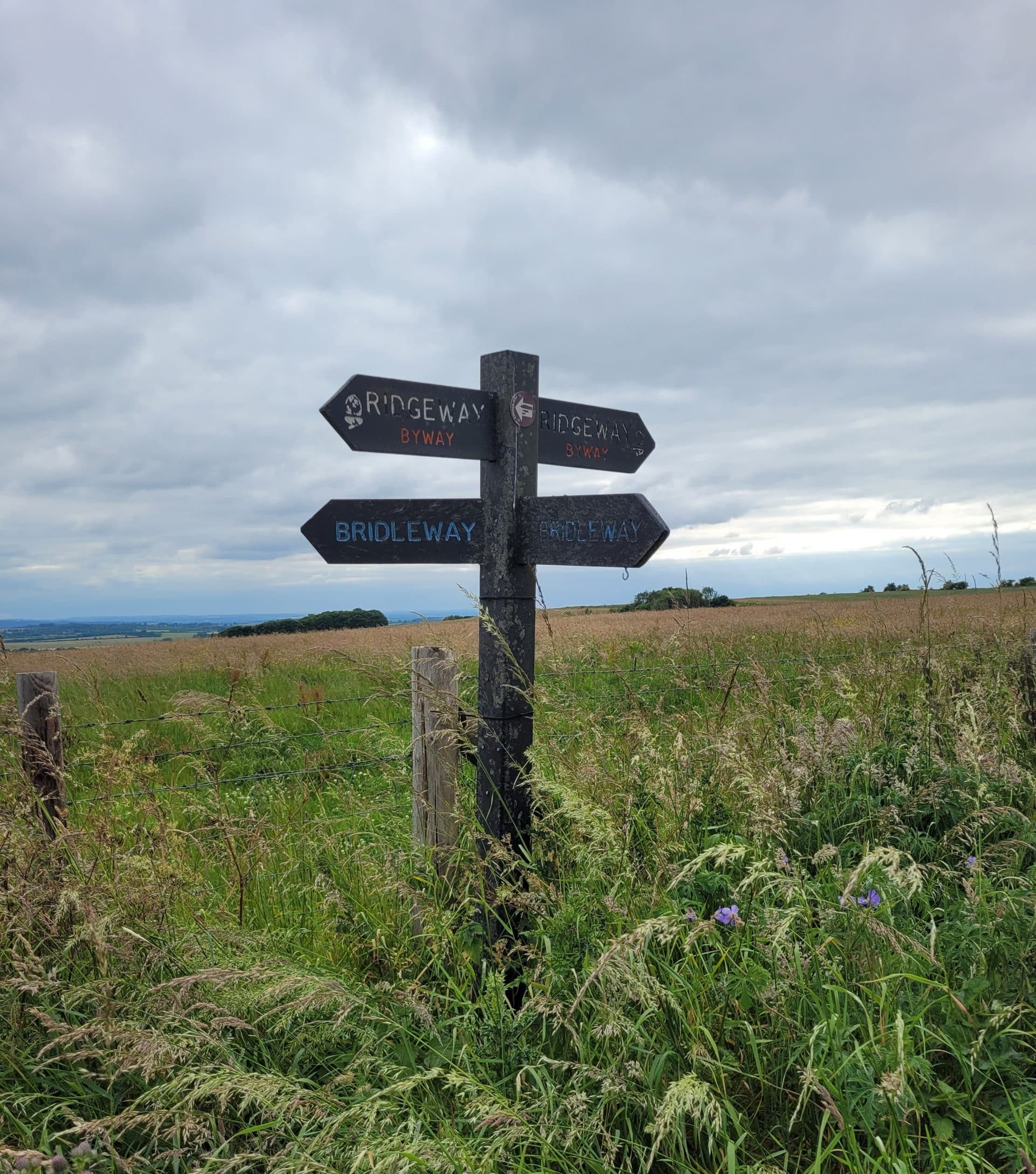
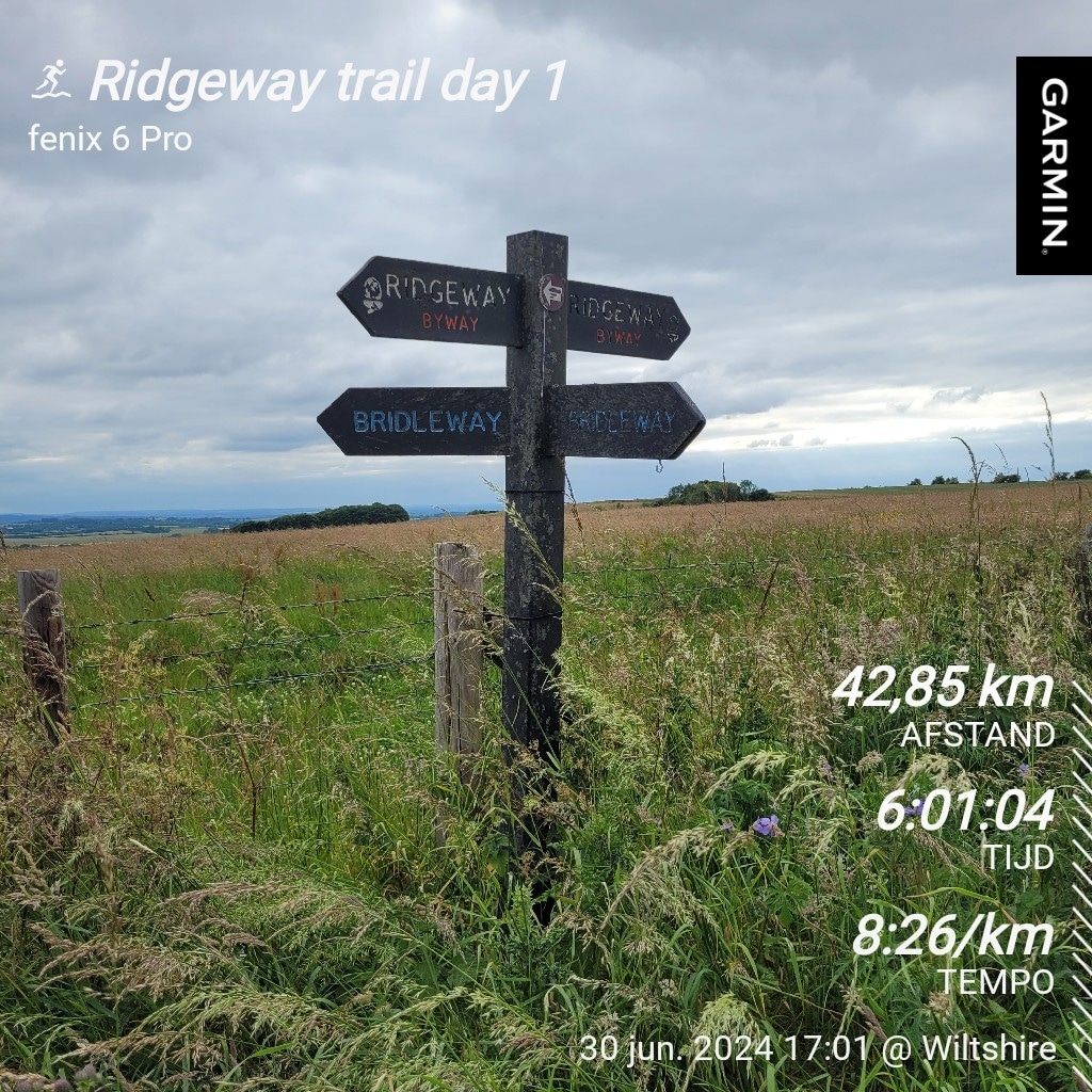
Day 1: Avebury to Westcot – 42.84km and 643 altitude meters.
After a very smooth ferry crossing towards England, I left Ine and the children in Dover from where they could take the train to London. A long drive awaited me to Avebury from where I would start the trip. For those who complain about the long traffic jams in Belgium, my advice is to take the ring road around London. Since it was Sunday, I expected a quick drive, but nothing was further from the truth. The travel time on google maps kept rising and it was finally well after 4pm when I arrived at Avebury.
Avebury is very well known for its henge and stone circles, which are one of the greatest wonders of prehistoric Britain. The henge was built and greatly altered during the Neolithic period, roughly between 2850 and 2200 BC. The henge is preserved as a huge circular bank and ditch, enclosing an area that includes part of the village of Avebury. Within the henge lies Britain's largest stone circle - originally about 100 stones - which in turn encloses two smaller stone circles.
Because of this familiarity, it is not very easy to park in Avebury during the day, but because it is very remote there is hardly any activity at night. So after making some enquiries at the museum, there is great concern about the safety of the car throughout the nights I will be absent. But thanks to the very friendly staff at the museum, we decide to put the car in a residents' car park and I leave my details in case there are any problems. Finally, it is 5pm by which time I can start my tour.
Given the limited altimeters, I aim to walk at least at 8km/h, as it will be much later at the start than I had anticipated. Then it will be a good 5h walk to the B&B I booked. But soon I have to admit that the hike will be heavier than planned, the backpack weighs me down and is not really comfortable while walking. The landscape during the hike is beautiful, but rather boring, especially for someone used to walking through the Alps. The last 10km I have to get the headlamp out because it gets too dark to continue the trek safely. Walking in the dark has never really been my favourite, but it does make you see more animals. I see many rabbits, a deer and for a moment I am startled by a weasel that wants to walk with me.
It is eventually 11pm by the time I reach my sleeping place, where I make some quick noodles and take a quick bath, before crawling into my bed for a short sleep.
Day 2: Westcot to Watlington – 54.74km and 697 altimeters.
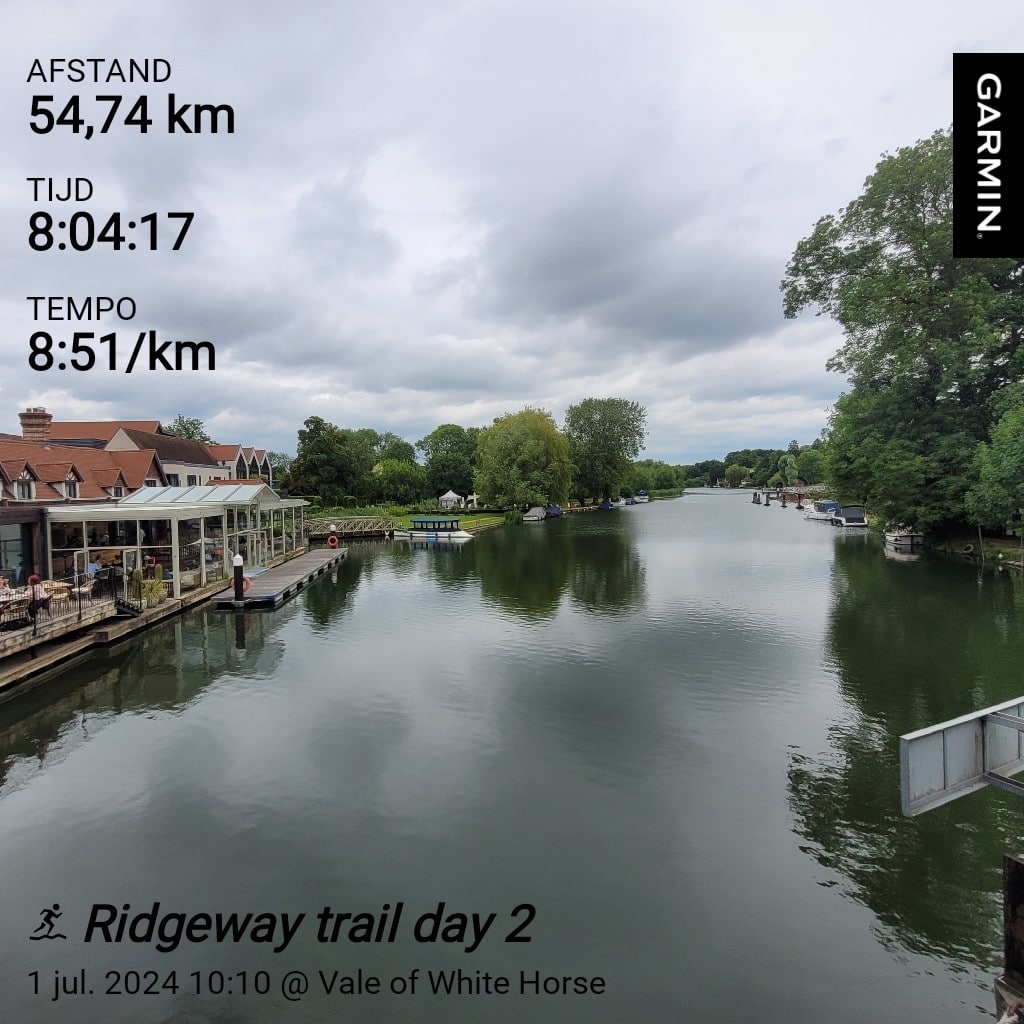
Today the longest distance, but also the most time. After a leisurely breakfast, I start the trek at leisure, aiming to complete the day at least at 8km/h. Therefore, I start very slowly and alternate walking with hiking, in a way that makes me feel like I could go on forever. Today a bit more of yesterday, beautiful wide landscapes but with little variety. Then, when I run out of drink three hours before the finish, things get really tough. And like many trails, most of the fun is had before the end, as almost all the altimeters are in the last 15km. So I am exhausted and dehydrated when I arrive at "The fat fox Inn", my second and last stop on the Ridgeway trail.
Day 3: Watlington to Tring - 42.95km and 813 altimeters.
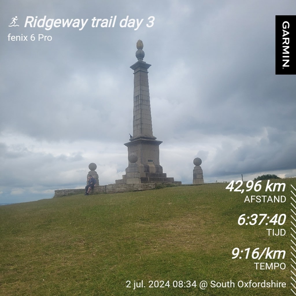
Today another early start. With over 40km to go, the shortest day of the trip, but with the most altimeters. This trip is clearly marked, but several times I was very pleased that I had downloaded the gpx from komoot. This gpx had guided me flawlessly until now, but soon I get a suspicion that the person who made the gpx did not hike the last part. Whole sections are just a straight line on the map, while in reality it is a winding path. At times it even deviates so much from reality that after 12km I take a wrong path which leads me to the toughest climb of the whole trip. Once at the top, a friendly Englishman manages to tell me that I am no longer on the Ridgeway trail, but that it runs below me. Lightly cursing, I turn back only to quickly realise my mistake at the bottom and continue on the trail. Twice more I almost miss the trail but each time I quickly find the path. The path is more varied and technical today, which combined with my fatigue means I can't reach the 8km/hour anymore. It is a matter of dragging my own feet and being disappointed every time a km has passed. I am relieved when I reach Tring, a bit later than I had hoped but also 3 km further than planned.
Final conclusion: The ridgeway trail is a nice trek with no really difficult technical sections. To do it in the indicated 6 or 7 days I think is excessive, three to four days is definitely doable for anyone with a good base. As altitude training for Manaslu, it won't have contributed much, but it was good training in keeping going and being alone (didn't encounter many people throughout the trek).
Leuk Filip. Deze tocht zal je altijd bij blijven, want een eerste meerdaagse solo tocht waarbij je zelf alles meesleept doet dat met je. Zo heb je een mooie blijvende herinnering.